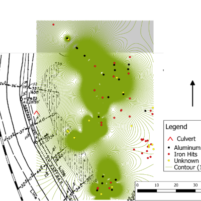
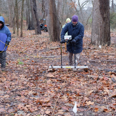
From November 3 to November 16 and on November 26, 2018 SHiP conducted a geophysical survey of a 2.5-acre area in the Northwest corner of the Valley View restoration area during November 2018. According to historical research and local lore, this area is the location of a boatyard built by the United States Army during the War of 1812. historical records suggests that just over 200 years ago, the survey area may have been the site of a modest boatyard used for making military watercraft for use in the War of 1812. Physical evidence is limited to two large, somewhat amorphous depressions in a flat floodplain near the Cuyahoga River. The more intact
depression measured roughly 40m by 20m in extent. These depressions presented as wetlands; their maximum depth was approximately 1 meter. The goal of the survey was to determine if there were any subsurface features present that relate to this boatyard.
The methods employed in this survey failed to produce any clear evidence for structures that might be associated with the possible existence of a boatyard dating back 200 years. This does not mean that the boatyard was not located here, but rather that the test results were inconclusive. The area has clearly been flooded over the past two centuries and the widespread layer of modern trash on the surface suggests that waterborne debris is regularly deposited here. Furthermore, the runoff from the water systems that utilize the culverts that drain into this area may add to the overburden that is accumulating in this area. It may be that the depth limitations of these particular shallow subsurface geophysical technologies (roughly 2 meters with the magnetic gradiometer and 1 meter with the electrical resistivity equipment) may not be able to penetrate deeply enough to reach deposits dating back to the early 19th century.
Full report will be uploaded to the Digital Archaeological Record (tDAR) in 2026.


