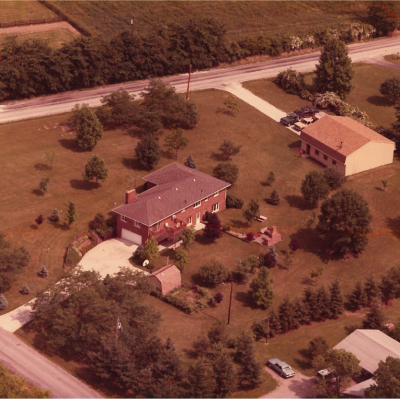
The goal of the archaeological investigation was to identify prehistoric and historic cultural resources within the project area, and to determine the eligibility of identified resources for the National Register of Historic Places (NRHP). The survey also provided excellent conditions for students of the University of Akron to learn how to dig shovel test units, which are small test pits excavated at regular intervals (usually 15 meters) to sample an area for archaeological data.
Shovel test pits were excavated in 15-meter intervals across the property to identify prehistoric and historic cultural resources. In the event of a positive shovel test, radial shovel test pits were excavated at 5-meter intervals to identify the boundaries of the artifact distribution. Soil probes were taken at potential shovel test locations to determine the disturbance of the soil in a specific location. Soil probes with disturbed profiles or truncated layers were determined ineligible for shovel testing. Soil probes were also used to determine the extent of soil layers within the project area. A total of 21 shovel test pits were excavated, equivalent to 10.5 square meters of the roughly 2-acre property.
Out of the 21 shovel test pits excavated, eight were positive for cultural materials. Three of these contained evidence of grading and fill from the addition of the eastern wing of the house. One yielded a piece of copper tubing, plastic, and brown and clear bottle glass, while two other test pits yielded fragments of modern brick and mortar. The brick fragments look very similar to the brick on the older portion of the house, and likely represent the former wall on the eastern side of the house that was torn out for the addition. Six of the test pits were truncated and disturbed with fill. These areas were disturbed by the construction of the house and outbuildings postdating 1966.
An unexpected soil layer was encountered in several of the test pits. The layer consisted of a dark, black loam roughly from 10-30 cm below the surface. Round nail fragments, one piece of whiteware, a piece of lithic shatter, and a chert chunk were recovered from this soil layer. This site was recorded as the Vinyard site, 33 SU 682. Based on the soil profiles of the surrounding shovel test pits, this layer is likely the result of high organic deposits, possibly from a garden post-dating the construction of the house. Based on the 1952 USDA aerial photograph of the project area, the land was plowed and no structures or distinguishable activities could be identified in the area of the soil layer. It is also possible this layer represents manure deposits from historic farming.

