This project involved an archaeological geophysical survey at Schneider Park in west Akron. The work was conducted in June and July, 2017. A portion of the park property includes an unmarked cemetery that was originally part of the former Summit County Infirmary from 1849 to 1919.
The survey area as confined to the north and west central portion of the park, which was identified as the most likely area to contain burials. The goal of the geophysical survey was to delineate the boundaries of a historic cemetery and to identify the minimum number of burials.
The archaeological geophysical survey of the cemetery was conducted using two terrestrial subsurface techniques: magnetic gradiometry and electrical resistivity. These were combined with a ground-level visual surface survey and an aerial drone survey. The results of these four survey techniques were combined to identify possible graves and to rate the reliability of each identification.
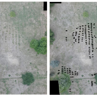
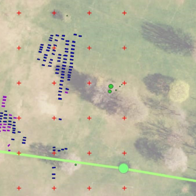
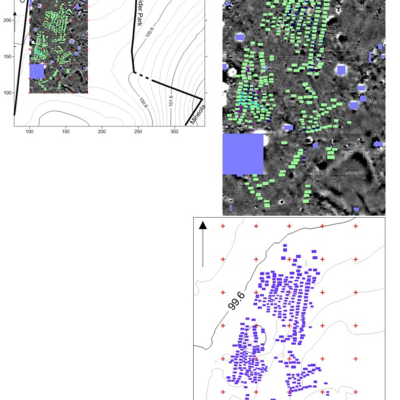
114 graves were located by visual survey at ground level. 156 graves were visible on the drone survey. Through magnetic gradiometry 311 graves were recorded, again with considerable overlap with the first two techniques. Electrical resistivity was the least effective technique given the field conditions (the dry summer soils were not ideal for conducting subsurface electrical currents, hindering interpretation) and only 15 graves were detected.
In total, 384 graves were confirmed by at least one survey method. Of these, five graves were identified in all four survey methods of survey; 89 were located by three of the techniques; 19 were located by two methods of survey; and 271 graves were only documented by one of the survey methods. The drone and magnetic gradiometry surveys identified 94.5% (n=363) of all graves.
Full report will be uploaded to the Digital Archaeological Record (tDAR) in 2026.


